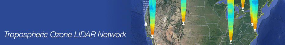
TOLNet, currently comprising five lidars (3 mobile systems in ESRL, LaRC, and GSFC and 2 fixed base systems at TMF and UAH), is an interagency initiative started by NASA R&A, NOAA/ESRL, and EPA in 2011. TOLNet provides high-resolution spatio-temporal measurements of tropospheric (surface to tropopause) ozone and aerosol vertical profiles to address fundamental air-quality science questions in cooperation with national, state, and local organizations and to support the DISCOVER-AQ, GEO-CAPE, and TEMPO missions. TOLNet also develops recommendations for lower-cost, more-robust lidar systems to better enable their more widespread use.
|