Satellite Imagery (Weather Focus):
· College of DuPage Satellite Page: https://weather.cod.edu/satrad/
· NASA Satellite Imagery Page: https://weather.msfc.nasa.gov/GOES/
· CIRA/CSU/RAMMB SLIDER: http://rammb-slider.cira.colostate.edu/
· SSEC Real Earth: http://re.ssec.wisc.edu/
· NASA Worldview: https://worldview.earthdata.nasa.gov/
· Weathernerds Custom Satellite Viewer: https://www.weathernerds.org/satellite/
· Tropicaltidbits Satellite Viewer: https://tropicaltidbits.com/sat/
Model Data (NWP):
· Tropicaltibits Model Viewer: https://tropicaltidbits.com/analysis/models/
· Weatherbell (requires login): http://models.weatherbell.com/
· Pivotal Weather: https://www.pivotalweather.com/model.php
· Alicia Bentley GFS Maps: http://www.atmos.albany.edu/student/abentley/realtime.html
· Tomer Burg’s Maps: http://www.atmos.albany.edu/student/tburg/analysis/
· College of DuPage Model Page: https://weather.cod.edu/forecast/
· Storm Prediction Center Mesoanalysis Page: https://www.spc.noaa.gov/exper/mesoanalysis/
· Storm Prediction Center HREF Viewer Page: https://www.spc.noaa.gov/exper/href/
· Weathernerds Model Viewer: https://www.weathernerds.org/models/
· Weathermodels.com (requires login): https://weathermodels.com/
· WxCharts: http://wxcharts.eu/
Analysis & Observation Data (Meteorology):
· Mesowest Data: https://mesowest.utah.edu/index.html
· RAL Real-Time Surface Maps: http://weather.rap.ucar.edu/surface/
· NWS Weather & Hazards Viewer: https://www.wrh.noaa.gov/map/?obs=true
· NWS Home Page: https://www.weather.gov/
Radar Data:
· College of DuPage Radar Viewer: https://weather.cod.edu/satrad/nexrad/
· National Weather Service Radar Viewer: https://www.weather.gov/Radar
· Weathernerds Radar Viewer: https://www.weathernerds.org/radar/
Miscellaneous Weather:
· Blitzortung Lightning Mapper: https://www.lightningmaps.org/
· NASA SPORT: https://weather.msfc.nasa.gov/cgi-bin/sportPublishData.pl?dataset=goeseastglm
Fire Perimeters, Incident Information, and Satellite Fire Detections:
· Inciweb: https://inciweb.nwcg.gov/
· Calfire: http://www.fire.ca.gov/current_incidents
· USFS Active Fire Mapping Program: https://fsapps.nwcg.gov/afm/index.php
· Fire Information for Resource Management System: https://firms.modaps.eosdis.nasa.gov/
· NWCG Interactive Hot-Spot Map: https://maps.nwcg.gov/sa/
· GACC Northwest Large Fire Interactive Map:
· https://gacc.nifc.gov/nwcc/interactivemap/index.html?webmap=ed0a7dad32fe4848b20c6f91c74c79ea
· NIFC: https://www.nifc.gov/fireInfo/fireInfo_main.html
o National Wildland Fire Outlook:
https://www.predictiveservices.nifc.gov/outlooks/outlooks.htm
· GACC: https://gacc.nifc.gov/
Information on Canadian Wildfires
· Alberta:
o Fire Map (works in chrome): https://esrd.maps.arcgis.com/apps/webappviewer/index.html?id=0b85f87569974de196bf2c82c09e2cc5
o Facebook page: https://www.facebook.com/AlbertaWildfireInfo/
o Forest Areas:
https://wildfire.alberta.ca/resources/maps-data/documents/ForestAreas-Oct09-2018.pdf
· British Columbia:
o Main page: https://www2.gov.bc.ca/gov/content/safety/wildfire-status/wildfire-situation
o Interactive map:
· Saskatchewan:
o Main page:
https://www.saskatchewan.ca/residents/environment-public-health-and-safety/wildfire-in-saskatchewan
o Interactive map: https://gisappl.saskatchewan.ca/Html5Ext/?viewer=wfmpublic
Aerosol Model Output:
· RAP Smoke: https://rapidrefresh.noaa.gov/RAPsmoke/
· HRRR Smoke: https://rapidrefresh.noaa.gov/hrrr/HRRRsmoke/
· NRL NAAPS: https://www.nrlmry.navy.mil/aerosol_web/
Air Quality/PM data:
· Aerosol Watch (NOAA): https://www.star.nesdis.noaa.gov/smcd/spb/aq/AerosolWatch/
· AirNow: https://www.airnow.gov/
· EPA: https://www.epa.gov/outdoor-air-quality-data
· Idaho Smoke Information: http://idsmoke.blogspot.com/
· Idaho Satellite Smoke Analysis: https://arcg.is/1zfeqH
· Idaho DEQ (ag burning): http://www.deq.idaho.gov/air-quality/burning/crop-residue-burning/
· Montana PM2.5: http://svc.mt.gov/deq/todaysair/?source=mobilenav
FIREX-AQ Ground Observations (Chemistry/Aerosol):
· ???
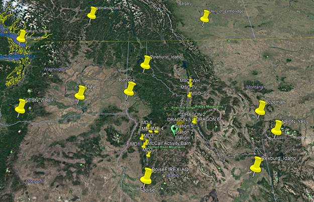
Map of FIREX-AQ ground sites:
FIREX.kmz (POC = Brent Holben, brent.n.holben@nasa.gov)