Day: 322 (18 November 1995)
Mission:
Primary Mission : Stratocumulus Alternate Mission: Clear Air Closure Future Mission(s) : Possible Monday (20 Nov 95) flightAircraft Operations
Take-off Time:Primary 0900 LDT (18th, 2200 UTC) Alternate 1000 LDT (18h, 2300 UTC) Pre-flight Weather Briefing Time: 0700 LDT (18th, 2000 UTC) Updates: 0800 LDT (18th, 2100 UTC) , primary vs. alternate Airborne Mission Scientist: Primary Lenschow Alternate, Clarke Mission Scientist: HuebertShip Operations
Discoverer: Discoverer in Macquarie Is. At 1400 UTC 17 Nov. All instrumentation are operational except CO and ammonia. Detailed measurements samples available on catalog. ISS soundings being taken every six hours. Ship returning to Hobart per directions from NOAA PMC. Discoverer Lead Scientist: Tim Bates Southern Surveyor: Southern Surveyor west of Cape Grim at first station. Soundings being taken every 12 hours. All other instrumentation in good order. Southern Surveyor Lead Scientist: Bronte TilbrookSystems Status:
Aircraft: PMS probes are operational. Lidar working on one channel. Discoverer: All major systems on Discoverer are operational. Some problems in acquiring Omega signal at these high latitudes. Ammonia and seawater CO systems are not operational. So. Surveyor: All major systems operational on Southern Surveyor. Cape Grim: Cape Grim installation continues. Most systems are operational and work continues on ammonia, SO2 and The ISS has operational OMEGA and profiler. RASS system is down. Macquarie Island: All systems operational. Six hourly soundings are being taken.
GASP trajectory analysis is here
ACE - 1ACE-1 FORECAST
SYNOPTIC AND PROGNOSTIC OVERVIEW
ISSUED :07Z Saturday 18/11/95
VALID TILL: 12Z Sunday 19/11/95
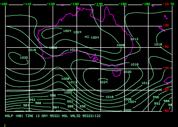
Synoptic Situaton at 00Z: Low 997 hPa moving SE at 25 knots forecast to be near 48S 159E at 12Z tonight and south of NZ by 12Z Sunday night. Low near 61S 149E moving eastwards and intensifying, forecast to be southeast of Macquarie by 12Z tonight. High 1024 hPa near 41S 126E moving east at 20 knots. High forecast to be near 44S 135E at 00z tomorrow, central pressure 1026 hPa and near 46S 142E at 12Z, central pressure 1027 hPa. A ridge still extends well south of the high towards 60S 130E, through the region of clear air where the C-130 is currently sampling.
Prognoses:
0-24 hours: All the guidance is quite similar with the high moving slowly into the ACE area and the ridge extending eastwards towards 60S 150E. The high and associated ridge should maintain quite stable conditions through the area tomorrow. The ridge is also likely to maintain the generally cold SW'ly stream through the Macquarie Island area for the next 24 hours at least.
24-72 hours: The high is forecast to move to the south and east of Tasmania on Monday and Tuesday, ahead of a trough which is forecast to cross Tasmania around the middle of next week. The Australian GASP model, which did quite well in predicting the movement of the low near Tasmania for this weekend, is showing the next trough crossing the state on Tuesday, whereas the other global models are quite a deal slower in their movement of this system. I tend to favour the GASP at this stage, although the differences between them are not terribly significant..
FORECASTS FOR TONIGHT AND SUNDAY 19/11/95:
Cape Grim/Southern Surveyor:
Weather: Showers tonight gradually easing overnight and clearing during tomorrow morning, but possibly persisting on the Southern Surveyor if you are more than about 25Nm offshore.
Winds: South to southwest winds 20 to 30 knots easing to 15 to 25 knots overnight and tending south to southeasterly at 15 to 20 knots during the morning. A further decrease to 10 to 15 knots in the afternoon. 3 to 4 metre seas decreasing to 1 to 2 metres. Southwest swell around 3 to 4 metres.
Macquarie Island/Discoverer:
Weather: Showers of sleet and snow, easing slowly for the Discoverer as she moves further north tomorrow.
Winds: West to southwest winds 25 to 30 knots, although somewhat lighter on land, easing to 20 to 25 knots on the Discoverer north of 50S. Seas 3 to 5 metres decreasing slowly north of 50S. 4 to 6 metre southwest swells.
REVIEW OF PREVIOUS DAY:
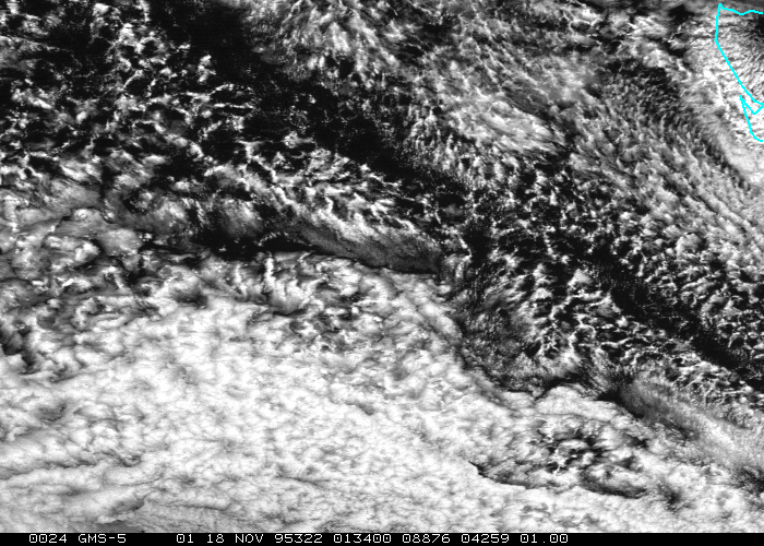
The cloud free area moved according to plan, however a part of the area filled with low level SC, resulting in the mission having to fly a little further south than planned. Winds at Cape Grim turned southwesterly as predicted but did nor strengthen to the 30/40 knots predicted, staying around 25/30 knots. Weather in the Macquarie/Discoverer area was much as forecast with some snow developing, however, winds did not strengthen as quickly or quite as much as was forecast. Observations from these sites have been very limited today though.
The statocumulus cloud mission is a unique opportunity to examine the boundary layer covered with clouds in a pristine environment. Stratocumulus clouds process large volumes of boundary layer air and significantly alter the structure of the boundary layer by changing its radiative, thermodynamic and chemistry balance. Recent results from the Southern Ocean Cloud Experiment (SOCEX) indicate the importance of drizzle in coupling and decoupling of the clouds with the surface layer.
In the pristine environment over the Southern Ocean CCN concentrations and DMS are closely linked, and the stratocumulus flight has been designed to adequately sample the sub-cloud CCN structure and the in-cloud droplet distributions. Furthermore, the flight patterns (Lenschow circles) will enable us to derive entrainment rates at the top of the cloud, and at the top of the surface boundary layer in case the cloud layer is decoupled from the surface.
The statocumulus cloud mission is a unique opportunity to examine the boundary layer covered with clouds in a pristine environment. Stratocumulus clouds process large volumes of boundary layer air and significantly alter the structure of the boundary layer by changing its radiative, thermodynamic and chemistry balance.
Recent results from the Southern Ocean Cloud Experiment (SOCEX) indicate the importance of drizzle in coupling and decoupling of the clouds with the surface layer.
In the pristine environment over the Southern Ocean CCN concentrations and DMS are closely linked, and the stratocumulus flight has been designed to adequately sample the sub-cloud CCN structure and the in-cloud droplet distributions. Furthermore, the flight patterns (Lenschow circles) will enable us to derive entrainment rates at the top of the cloud, and at the top of the surface boundary layer in case the cloud layer is decoupled from the surface.