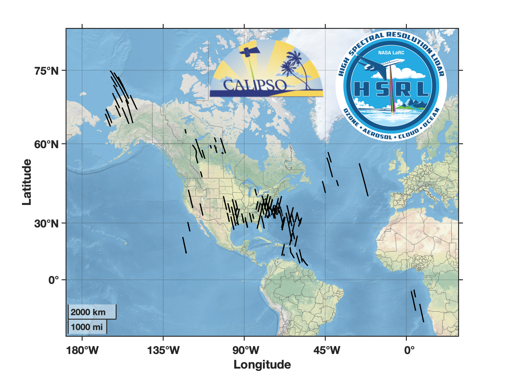
 The Cloud-Aerosol Lidar with Orthogonal Polarization (CALIOP) instrument on the Cloud-Aerosol Lidar and Infrared Pathfinder Satellite Observations (CALIPSO) spacecraft has provided
global, high-resolution profiles of aerosols and clouds since it became operational on 13 June 2006. From 14 June 2006 to 18 August 2022, the NASA Langley Research Center (LaRC)
High Spectral Resolution Lidar (HSRL) has been deployed on several NASA aircraft for a total of 147 underpasses of the CALIPSO satellite to provide validation measurements for the
CALIOP data products.
The Cloud-Aerosol Lidar with Orthogonal Polarization (CALIOP) instrument on the Cloud-Aerosol Lidar and Infrared Pathfinder Satellite Observations (CALIPSO) spacecraft has provided
global, high-resolution profiles of aerosols and clouds since it became operational on 13 June 2006. From 14 June 2006 to 18 August 2022, the NASA Langley Research Center (LaRC)
High Spectral Resolution Lidar (HSRL) has been deployed on several NASA aircraft for a total of 147 underpasses of the CALIPSO satellite to provide validation measurements for the
CALIOP data products.
Please review
CALIPSO-HSRL_Underpasses_README.pdf,
CALIPSO-HSRL_Underflights.kmz.
CALIPSO DOI: 10.5067/CALIOP/CALIPSO/CAL_LID_L1-Standard-V5-00
|
|
|