|
APMAC –
Appalachian
Active
Passive
Methane
Airborne
Constraints
 Data Archive: APMAC Data Archive: APMAC

|
|
|
|
Project Overview
The goal of APMAC is to create remote sensing data sets at regional scale that directly constrain the methane emissions for important source regions.
The MethaneAIR and HALO instruments will be utilized on the G-III, and coincident observations by the MethaneSAT satellite, with repeated surveys of the same region two-day periods, to create
uniquely data-rich, comprehensive observations of methane concentrations and their changes over time that can fully constrain regional emission rates.
The goal is to deliver three "Benchmark datasets" at regional scale, rich in remote sensing observations, where the emissions can directly be constrained in time and space within narrow limits.
These datasets will enable rigorous testing of the accuracy of the inverse models used to quantify regional emissions, providing validation, and enhancing credibility for methane emission assessments based on remote sensing.
- Airborne Platforms Deployed On: NASA Langley Gulfstream-III
- Groups Involved: HALO, MethaneAIR (Harvard), MAGEQ (SARP, NOAA, COURAGE... )
|
Goal: provide rigorous test of "top down" regional area flux models |
- There is currently no way to validate inverse models
- Designed to tightly constrain inverse models by spatially and temporally resolving atmospheric burden of methane as it sets up and evolves over a 2-day period
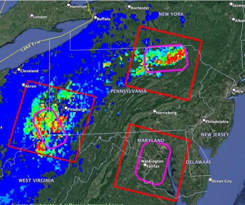
- Create a high-resolution map of methane over several large (80 x 120 km) regions, oversampling in time spanning several days
- Repeat experiment at 3 sites - 2 areas of Appalachian basin + Washington DC/Baltimore urban area
|
 |
|
|
|