Data Archive: STAQS 2023 Data Archive: STAQS 2023

 STAQS Data Use Policy STAQS Data Use Policy
|
|
NASAs Tropospheric Emissions: Monitoring of POllution ( TEMPO) mission
launched in April 2023 to provide geostationary observations of air quality over North America. With this addition of high-resolution satellite measurements,
the Synergistic TEMPO Air Quality Science ( STAQS) mission sought to integrate TEMPO satellite observations
with traditional air quality monitoring to improve understanding of air quality science and increase societal benefit of the mission.
 The colored blocks on the map represent of locations mapped by NASA aircraft during STAQS with noted flight dates. White circles show ground locations for measurements (PGN and TOLNet) supported by STAQS. Dates in yellow are those that coincide with TEMPO observations.
Between June-August 2023, STAQS operated two aircraft on 17 flight days totaling to ~270 flight hours in four domains: Los Angeles, New York City, Chicago, and Toronto. Measurements include column NO2, HCHO, and methane, ozone and aerosol profiling, and methane/CO2 emission rate estimates.
The framework for STAQS stemmed from measurements strategies and collaborations developed during airborne air quality studies from the last decade.
For STAQS, NASA collaborated with partners conducting complementary air quality studies in 2023 (full list summarized on the AGES+ website)
building a synergistic observing system more robust than any singular entity could provide alone.
To date, measurements from STAQS and AGES+ have been heavily used in TEMPO validation, which contributed to the TEMPO team achieving provisional
validation status for their NO2, HCHO, and ozone products in
December 2024.
Ongoing work includes, but is not limited to continued evaluation of
TEMPO level 2 products
geo-physically, spatially, and temporally, interpreting the temporal and spatial evolution of air quality events tracked by TEMPO, and improving temporal estimates of anthropogenic, biogenic, and greenhouse gas emissions.
Airborne Air Quality Remote Sensing:
The airborne air quality TEMPO-proxy payload was installed on Johnson Space Centers G-V. Over the course of summer 2023, this payload operated
over 13 flight days (last flight August 15th) collecting data with the GeoCAPE Airborne Simulator (GCAS) combined with the High Spectral Resolution
Lidar (HSRL)-2 + Ozone Differential Absorption lidar (DIAL). This payload was first demonstrated on this platform during
the TRACER-AQ mission in September 2021 and
provided repeated high-resolution mapping of NO2, HCHO, ozone, and aerosols up to 3x per day over targeted cities to capture the spatiotemporal
evolution of air quality due to emissions, meteorology, and chemistry. After August 15th, GCAS was placed on the NASA LaRC G-III in place of
AVIRIS to finish the mission in Los Angeles.
To compliment the air quality measurements from the G-V, a greenhouse gas focused payload flew on the LaRC G-III to measure city-scale emissions
up to 2x day over targeted cities. The combined active/passive remote sensing payload includes the High Altitude Lidar Observatory (HALO) and
Airborne Visible InfraRed Imaging Spectrometer - Next Generation (AVIRIS-NG).
HALO provides city-scale view of column methane using the DIAL technique and profiles of aerosol/cloud optical properties employing the HSRL technique. AVIRIS-NG provided methane and carbon dioxide emissions estimates over large sources.
 | |
 |
|
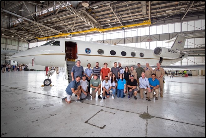
G-V and G-III group photos at Wright-Patterson AFB: Photo credit: Mónica Vázquez González |
TOLNet:
Continuous tropospheric ozone profiles add a critical component needed to understand processes relevant to air quality and pollution transport with TEMPO. The
NASA Tropospheric Ozone Lidar Network (TOLNet) contributed to STAQS
most heavily in the New York City domain (four systems operated by NASA, NOAA, and CCNY), the UAH system north of Chicago, and included the first deployment
of the Small Mobile Ozone Lidar (SMOL) in the Los Angeles.
Pandora Spectrometers:
Pandora spectrometers consist of a ground-based UV-VIS spectrometer capable of operating in direct-sun DOAS or multi-axis(MAX)-DOAS mode and is the primary validation instrument for the TEMPO mission. Twenty Pandoras operated as part of the Pandonia Global Network in the domains of interest for STAQS. Products from this instrument include NO2, HCHO, and Ozone.
| |
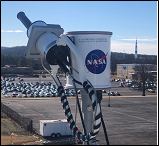
Pandora head sensor operating in Huntsville, Alabama.
Credit: Bob Swap/NASA
|
Ground based monitors:
STAQS analysis is leveraging the existing monitoring networks operated by the EPA and state air quality agencies within the domains sampled during STAQS. Relevant parameters include, but are not limited to, ozone, nitrogen dioxide, formaldehyde, and meteorology.
Other aircraft:
The collaborative activities associated with STAQS ( AEROMMA,
CUPiDS) included other airborne payloads
with in situ and remote sensing measurements relevant to TEMPO air quality science on board the NASA DC-8, NOAA Twin Otter, and UAH SeaRey.
Planning team:
| | |
| Laura Judd (Mission Scientist/Airborne Lead) |  |
| John Sullivan (Mission Scientist/Ground Lead/TOLNet PI) | |
| Jim Crawford (Science Advisor) | |
| Barry Lefer (Program Manager) | |
| Michael Shook (Data Manager) | |
| Gao Chen (Data Manager) | |
| Tyler Thompson (G-V Manager) | |
| Brendan Finnegan (G-V Mission Planner) | |
| Tom Hanisco (NASA Pandora Project PI) | |
| Jim Szykman (EPA Science Liaison) | |
| Luke Valin (EPA Science Liaison) | |
| Scott Janz (GCAS PI) | |
| John Hair (HSRL-2 PI) | |
| Amin Nehrir (HALO PI) | |
| Robert Green (AVIRIS-NG PI) | |
Collaborative Activities:
|