Mission Plan:
Primary Mission : Macquarie Is. Intercomparison Alternate Mission: Clear air closure Future Mission(s): Possible Intercomparison with Discoverer in vicinity of Cape Grim.Aircraft Operations
Take-off Time: N/A Flight #16: 0900 LDT, 27 Nov (2200 UTC, 26 Nov) Pre-flight Weather Briefing Time: Flight #16: 0700 LDT, 27 Nov (2000 UTC, 26 Nov) Updates: none Airborne Mission Scientist: Flight #16: Huebert (Alternate Mission: Durkee) Mission Scientist: Flight #16: Durkee (Alternate Mission: Huebert)Ship Operations
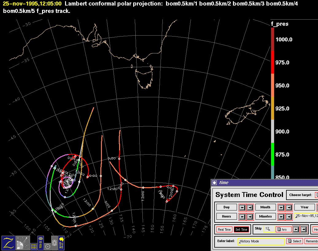
Discoverer: Discoverer continues NW along transect followed by Southern Surveyor to the west of Tasmania. They will arrive at the NW end of this line at 42S, 142E this evening. ISS soundings continue every 6 hours. See catalog reference below for detailed instrument status. Discoverer Lead Scientist: Tim Bates Southern Surveyor: Southern Surveyor position at 0000 UTC 25/11 is approaching station Trans-P5 49S 145.5E. They have completed all required measurements to this point. Soundings are being taken every 12 hours. See catalog reference below for detailed instrument status. Southern Surveyor Lead Scientist: Bronte Tilbrook
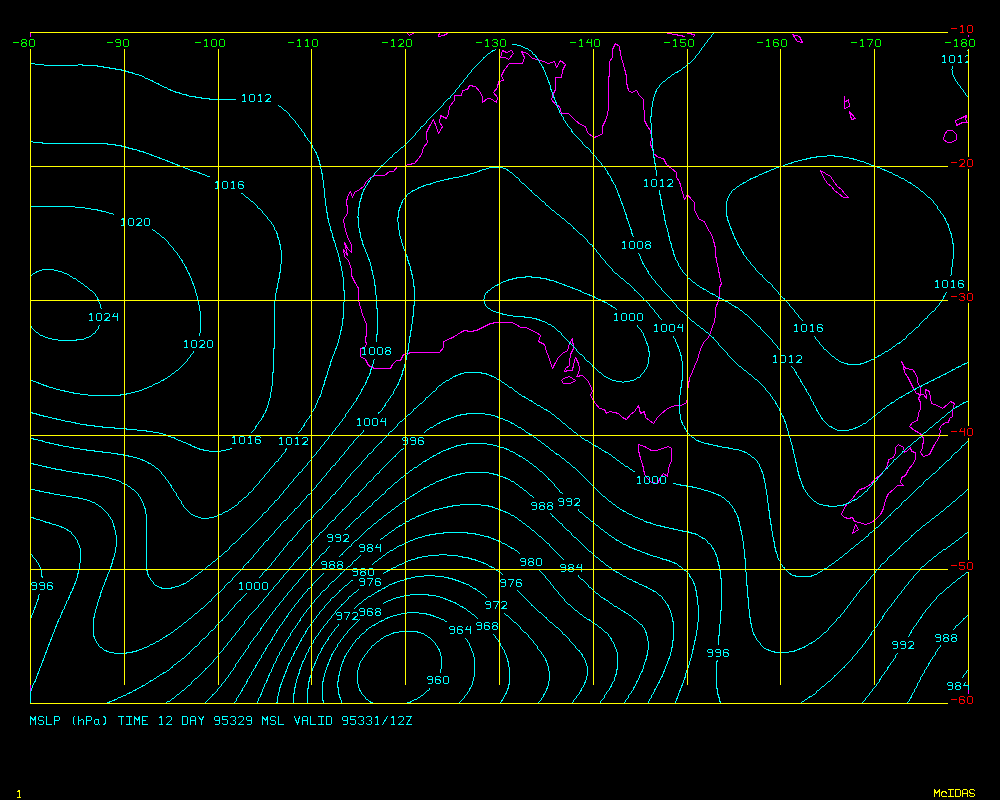
48 hour MSL P Prognosis is here
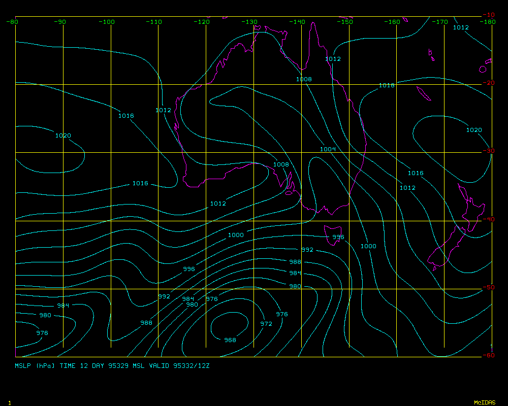
72 hour MSL P Prognosis is here
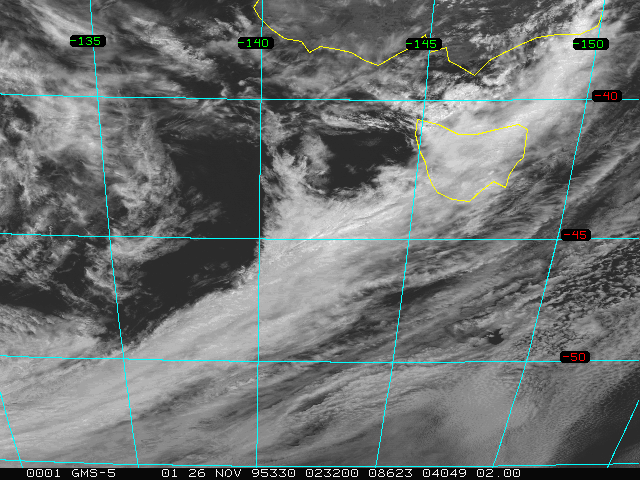
Latest Visible Sat Picture is here
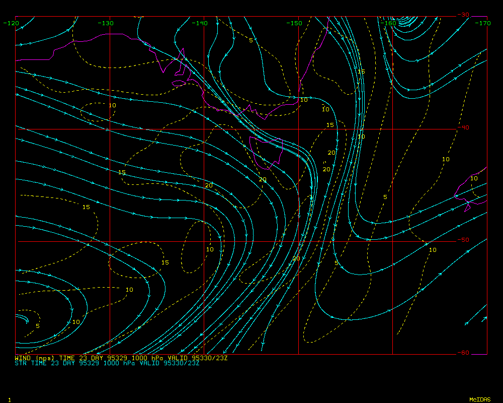
Surface Wind 24-h forecast is here
GASP trajectory analysis is here
Synoptic Situaton at 00Z Sunday 26/11/95:
High 1018 hPa near 49S 150E moving ESE at 15knots, forecast to be near Macquarie Island at 00Z tomorrow and east of Macquarie by 12z tomorrow night.
Cold front near line 38S 141E/46S 140E/wrapping around a 980 hPa low near 49S 128E moving SE at 30knots.
Small low 990 hPa near 42S 132E moving ESE at 30 knots and weakening.
Cold front near line 36S 120E/40S 125E/wrapping around a 982 hPa low near 43S 122E moving E at 35 knots forecast to be near line 40S 130E/48S 140E/50S 138E at 00z tomorrow and east of Tas to a 970 hPa low near 55S 135E at 12z tomorrow night.
Prognoses: 0-24 hours: Progs are showing the ridge holding on in the Macquarie Island region, maintaining quite light and dry S/SW winds through the area. Further west, a strong northerly gradient is being maintained ahead of the front that is currently just moving through Tasmania. Further fronts are then embedded in the ensuing, vigorous westerly stream, driven by a large and very deep low of around 960 hPa near 57S 120E.
24-72 hours: The longwave trough is expected to move only very slowly eastwards during the period and as a result, the large and very deep lows between 110E and 130E will continue to move only slowly eastwards and maintain their dominance of the ACE area.
FORECASTS:
Cape Grim: Weather: A few light showers increasing for a period tomorrow afternoon as the next front crosses. Mostly broken cloud. Winds: East to northeast winds 25/35 knots turning northwest to westerly 15/20 knots shortly. Northwesterlies restrengthening to 25/30 knots tomorrow morning ahead of a westerly change of 25 to occasionally 35 knots in the afternoon.
Macquarie Island: Weather: The chance of a light shower this evening but mostly fine tomorrow with some breaks in the cloud. Winds: South to southwest winds 10/20 knots easing to 5/10 knots tomorrow and becoming variable in direction in the afternoon then northeasterly tomorrow night.
R/V Discoverer Weather: A few light showers increasing for a period later tomorrow morning as the next front crosses. Mostly broken cloud. Winds: Northwest to westerly winds 20/30 knots increasing to 25/35 knots tomorrow morning ahead of a westerly change of 25 to occasionally 35 knots around noon. 3 metre seas increasing to 4 metres at times tomorrow. Westerly swell 3 to 4 metres.
Note: Northwest winds of 30/40 knots are likely to develop on Tuesday ahead of a front forecast to cross your area on Tuesday night, then again on Wednesday as a deep low below 960 hPa moves into the area around 52S 130E by Wed night.
R/V Southern Surveyor Weather: A little rain or drizzle developing this evening easing to a shower or two tomorrow morning. Showers increasing again later in the day. Winds: Northeast to northerly winds increasing to 20/30 knots this evening ahead of a 15/25 knot northwest change early tomorow morning. Winds returing to the north and increasing to 25/35 knots later in the morning ahead of another northwest change of similar strength later in the day. Seas rising 3 to 4 metres at times. West to northwest swell increasing to around 3 metres.
Note: North to northwest winds of 30/40 knots are likely to develop on Tuesday ahead of a front forecast to cross your area on Wednesday morning, then again later in the day as a deep low below 960 hPa moves into the area around 52S 130E by Wed night.
REVIEW OF PREVIOUS DAYs FORECAST: The front has moved faster than was forecast and as a consequence, winds strengthened quicker than was expected at Cape Grim and on the Discoverer. Rain also developed earlier than was forecast on the above. A very dry south to southwest stream has resulted in a fine day at Macquarie with the expected showers passing just east of the station. Conditions on the Southern Surveyor look to have been much as forecast.
Reporter: Barry Huebert
Tomorrow seems to be a good day for our flight to Macquarie Island. The air there has already begun to dry out, and we don't want to miss the opportunity to sample there in non-precipitating air. Two objectives are prominent: the first is an instrument intercomparison, with microphysical aerosol instruments and particle and DMS concentration measurements. That will only work if we are free of the heterogeneity that precip would cause. The second objective is to observe vertical profiles above the sea near Macquarie, and to measure the fluxes of species in that region.
Our plan, then, is to depart Hobart at 0900 local time, intending to arrive near Macquarie at around noon. Since there will be strong tailwinds, we may arrive slightly earlier. (We will maintain at least 1 km clearance from the shore, to avoid scaring any wildlife.) Our plan is to begin with a lidar leg across the diameter of a circle that ends about 4 km from the island, on the nearest side that keeps us abreast of the island, so that neither the C-130 nor the island is downwind of the other. We would then descend and fly four 25 minute circles in the boundary layer, ending with a sounding up to 10,000' and another lidar leg. If our station time is cut short by the headwinds which we are likely to face on our return, we might have to abandon the final lidar leg and do our profile on the climb out in the direction of Hobart. It is even conceivable that we would not get to finish all four circles, but we hope to have a bit more than 2 hours on station, which should be enough.
There will be a very good satellite overpass at about 0300 CUT, which will be just as we are leaving the island to start back. Thus, we may be able to look for column closure and compare our in situ aerosol observations to the integrated effects as observed by the satellite.
The alternate mission, if the morning observations report precip at Macquarie, is to do a column closure mission east of Tasmania. The launch would be delayed until 1000 local, so that two satellite overpasses could be caught.
We continue to seek opportunities to fly near Cape Grim while Disco is in the neighborhood. But the procession of fronts through the region is likely to continue for several more days, making it very hard to find a boundary layer which is well-enough behaved to interpret flux measurements or vertical profiles. We hope late tomorrow to retrieve a balloon transmitter from the ship, perhaps at Stanley.
It is unfortunate that the boundary layer was so complex and multilayered during the flight near Disco yesterday, because such missions offer an opportunity to achieve one of the primary goals of IGAC's MAGE (Marine aerosol and gas exchange) program: to intercompare independent means of estimating sea/air exchange rates. By flying a series of Lenschow circles in the vicinity of the ship, we can compare three totally different physical principles for estimating the DMS flux:
1. Liss & Slater or Wanninkhof thin-film approach. Using seawater DMS measurements and windspeeds, estimate the transfer coefficient in the traditional manner. Tim Bates is gathering data from the ship for this analysis. 2. From the observed gradient of DMS and the micrometeorological measurements in the Lenschow circles, derive the flux micrometeorologically. Drexel's DMS observations around the circles make this possible. 3. Use photochemical measurements to derive the rate at which DMS is being removed, and equate that to the source flux from the ocean. Doug Davis is modeling this process using hydrocarbon, OH, O3, CO, NO, DMS, and other chemical data from the C-130.
It really is exciting to think that we can make all three of these estimates side-by-side. Be assured that I will be looking for more opportunities to sample by the ship, since this same kind of analysis may be applied to other species (especially hydrocarbons) for which the air/sea flux is of interest.
We will be faxing overheads from this afternoon's science meeting to the other sampling sites, so that otehr people can benefit from the little bits of data we are finally taking a look at.